
Data sets
|
A major goal of our research group is to develop an improved understanding of human land use activities at continental to global scales. Consequently, we have been developing maps and datasets describing contemporary and historical global land use practices. You may freely download our data sets here, for non-commercial use.
Note: please be mindful of reading the associated publications and understanding appropriate use cases for the data. Generally, these data sets are meant to be used for global scale analysis, so they are not intended to capture spatial patterns within any country. |
|
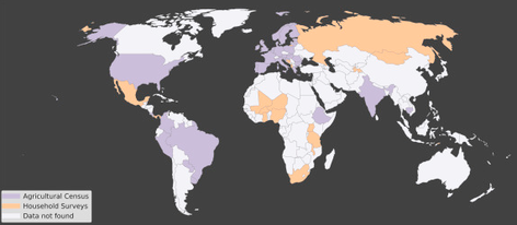
Crop Production by Farm Size
Described in the publication Ricciardi et al. (2018).
The data are provided in CSV and ESRI Shapefile formats. |

|
Global Fertilizer and Manure Application RatesDescribed in the publication Potter et al. (2010)
The data are provided in NetCDF and ArcGIS ASCII format at 0.5 deg resolution in latitude by longitude. |
|
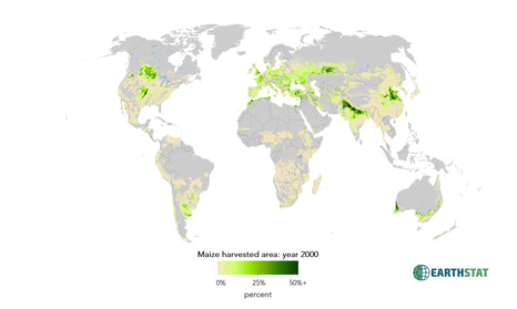
Harvested Area and Yields for 175 cropsDescribed in the publication Monfreda et al. (2008).
The data are provided in NetCDF and ArcGIS ASCII formats at 5 minute resolution in latitude by longitude. |
|
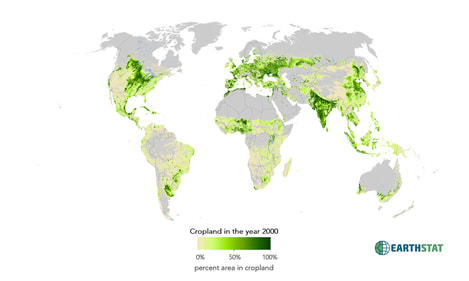
Cropland and Pasture Area in 2000Described in the publication Ramankutty et al. (2008).
The data are provided in NetCDF and ArcGIS ASCII formats at 5 minute resolution in latitude by longitude. |
|
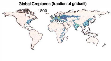
Historical changes in global land cover 1700-1992
Described in the paper Ramankutty and Foley (1999).
The data are provided in NetCDF and ArcGIS ASCII formats at 0.5 degree resolution in latitude by longitude. |
