Powered by Create your own unique website with customizable templates.
LUGE Lab
  • Home
  • People
  • Publications
  • Data
  • Projects
  • Opportunities
  • Outreach

Data sets

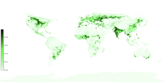
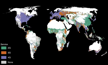
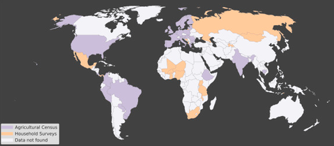
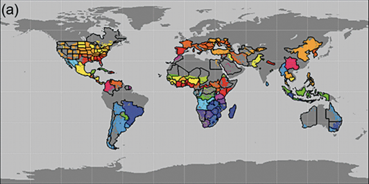
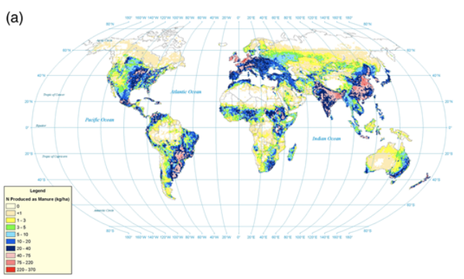
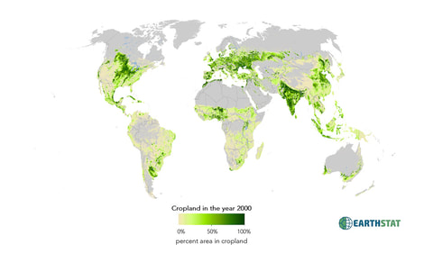
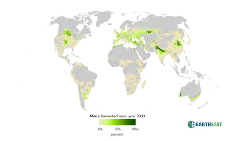
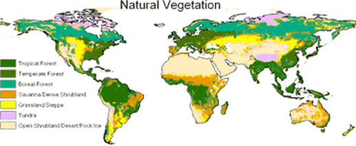
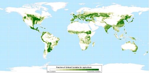
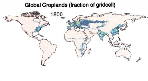
A major goal of our research group is to develop an improved understanding of human land use activities at continental to global scales. Consequently, we have been developing maps and datasets describing contemporary and historical global land use practices. You may freely download our data sets here, for non-commercial use. 

Note: please be mindful of reading the associated publications and understanding appropriate use cases for the data. Generally, these data sets are meant to be used for global scale analysis, so they are not intended to capture spatial patterns within any country.

Cropland and pasture area in 2015

Picture
Coming soon

Global coverage of mobile services

Picture
Data
paper (Mehrabi et al. 2020)

Crop production by farm size

Picture
DATA
Paper (Ricciardi et al. 2018)

Organic and conventional agricultural yields

Picture
Data
paper (SEUFERT et al. 2012)

Global crop calendars

Picture
Data
Paper (Sacks et al. 2010)

Global fertilizer and manure application rates

Picture
Data
Paper (Potter et al. 2010)

Cropland and pasture area in 2000

Picture
Data
Paper (RAmankutty et al. 2008)

Harvested area and yields for 175 crops

Picture
Data
Paper (Monfreda et al. 2008)

Global potential vegetation

Picture
Data
More information

Cropland suitability

Picture
DATA
Paper (Ramankutty et al. 2002)

Historical changes in global land cover 1700-1992

Picture
Data
Paper (Ramankutty & Foley 1999)

Powered by Create your own unique website with customizable templates.
  • Home
  • People
  • Publications
  • Data
  • Projects
  • Opportunities
  • Outreach
Powered by Create your own unique website with customizable templates.